Australian Pole of Inaccessibility
The Australia Point of Inaccessibility is approximately 175km West Northwest of the town of Alice Springs in the Australian Northern Territory, using the Haversine formula to calculate the distance. By road, it is around 230km from Alice Springs, the ‘Capital’ of the Australian Outback, via the Stuart Highway, Tanami Road and Kintore Road.
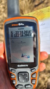
The exact location of the Australasian PIA is determined to be at:
- Latitude: 23°10.2’S
- Longitude: 132°16.2’E
- Distance from sea: 577 miles (928km)
The coordinates were calculated by Garcia-Castellanos & Lombardo in 2007 and published in the Scottish Geographical Journal.
Map of Australian Pole of Inaccessibility
This is the ‘original’ Australian Pole and the location which has been visited by quite a few people.
Visiting the Australian Pole of Inaccessibility
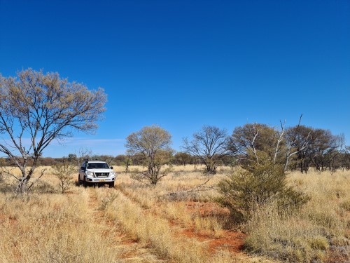
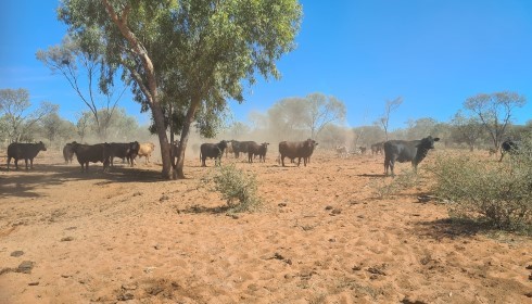
This pole of inaccessibility (and the Geoscience version below) lie on private land owned by the Hewitt Cattle Corporation on their Narwietooma Aggregation (more specifically the Derwent Station) and you will need their permission before visiting any of the poles. You could choose to visit by helicopter or, as we did, by 4×4 vehicle.
Our visit was facilitated by Kimberley Morgan who runs a small off road/tourist enterprise out of Alice Springs called Wild Honey Travels. Kimberley not only knows the area inside out, but she is closely integrated with the local people, both contemporary and traditional. Through her contacts we were able to acquire the necessary permissions to visit the pole. This included the assistance, for safety reasons, of the Station Manager, Terry, who guided us through the maze of small tracks, fences and gates, let alone the stock, that you encounter on a cattle station.
What is it like at the Australian Pole of Inaccessibility?
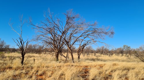
The poles are obviously remote. The earth is a scorched red colour and the vegetation is bordering on a sparse tropical savanna. You’ll need sturdy boots and long trousers if you want to avoid any cuts and scrapes.
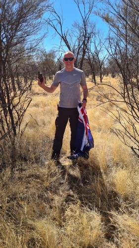
With Kimberley and Terry’s help, we were able to reach the exact Australian Pole of Inaccessibility as defined by Garcia et al. It lies from one of the farm tracks.
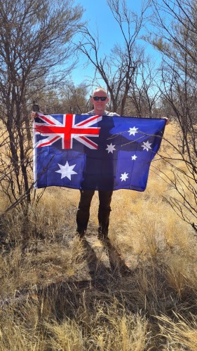
Date Visited: 11th May, 2022
Visited by: Chris Brown, Kimberley Morgan, Simika and Terry
Weather: 23 Celsius/74 Fahrenheit. Clear skies and Sunny. Low humidity
Coordinates Achieved: 23°10.2’S, 132°16.2’E
Distance from Pole: Zero metres. Exact Pole achieved
Australian Pole of Inaccessibility – more recent calculation
More recent calculations of the Australasian pole have put it at a slightly different spot.
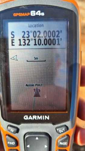
Geoscience Australia, in their paper “Centre of Australia States and Territories”, published on the 31st October 2016, made their own calculation based on improved mapping and greater computational power than those available to Garcia et al. They calculated the Pole of Inaccessibility to be at:
- Latitude: 23°02’S
- Longitude: 132°10’E
- Distance from sea: 575 miles (925km)
This calculation for the Australian Pole of Inaccessibility lies just 18.5km from the original point (again using the Haversine Formula).
Incidentally, midpoint of these two versions of the pole is at 23°?06??06??S, 132°?13??06??E.
If you have visited the Garcia Point, it will only take you around 20 minutes to drive to this ‘Geoscience’ version of the pole following the farm tracks and opening/closing the gates.
The exact polar coordinates are around 50m from the track. With Terry’s permission and aid we crawled under a barbed wire fence and accessed the exact pole.
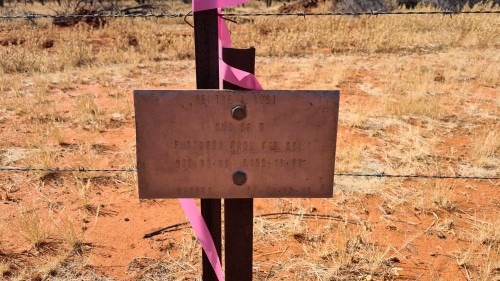
Incidentally, somebody has placed a sign on the track in the proximity of the pole, indicating its existence. Of course, the sign is within the error margins of the calculation for the pole, so it could be said to mark the pole itself.
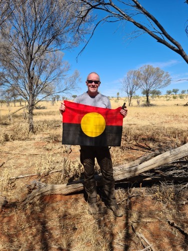
Visited by: Chris Brown, Kimberley Morgan, Simika and Terry
Weather: 23 Celsius/74 Fahrenheit. Clear skies and Sunny. Low humidity
Coordinates Achieved: 23°02’S, 132°10’E
Distance from Pole: Zero metres. Exact Pole achieved
Australian Centre of Gravity
Unusually the Centre of Gravity for Australia lies very close to the Pole(s) of Inaccessibility. So we took the opportunity to visit that location at the same time. You can read about the difference of Centre of Gravity and Pole of Inaccessibility here.
The exact location is several hundred metres from the closest track and the turn off is marked by a Steer’s skull hung from the nearest fence. It is also marked by two metal signs protected from the cattle by a triangle of metal beams:
One sign reads, “Centre of Australia. One of 7. CTR of Gravity. S23.7.00 E132.9.00” followed by what looks like the date, year 2000, and some initials, possibly RP, TH and PA?
Australian Mainland Centre
The second sign reads, “Australian Mainland Cadastral (?) Centre (sic). As calculated by Division of National Mapping, Belconnen ACT. This plaque was placed by Peter & Helen & Alicia & Megan Jones 23-2-1991. Location was by Magnavox MX4400 kindly loaned by [unreadable] Contracting of Alice Springs, way board (?) permission by Derwent Station”