Jamaica
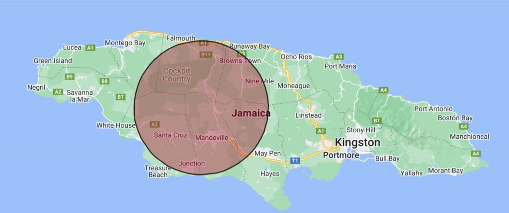
The Jamaican Point of Inaccessibility is on the side of a steep hill in Mile Gulley in the Pine Hills of Manchester Parish.
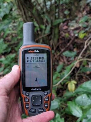
The exact location of the Jamaican POI is:
- Latitude: 18° 10.4759’ N
- Longitude: 77° 33.5321’ W
- Distance from coast: 34km
These coordinates were calculated by Chris Brown in November 2023.
Mapped Location of Jamaica Point of Inaccessibility
Getting to the Jamaican Point of Inaccessibility
Our journey to the Jamaican Point of Inaccessibility started from a resort on the South coast. For some reason none of the hire car companies had any stock available for the days I’d planned the trip. So, for a change, I opted instead to use a local driver, Trevor Myrie, who is known as one of the best tour guides in Jamaica.
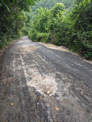
The journey took just short of two hours and went from Westmoreland parish, through Elizabeth and into Manchester Parish, mostly on the A2 and B6. The total distance was only 72km, but the roads are heavily potholed and progress was slow. With oncoming vehicles dodging the holes, you’d be hard pressed to tell which side of the road they drive on (officially, Jamaicans drive on the left, like in the UK).
At first, we passed through the ‘wetlands’ where Trevor assured us that the alligators were “friendly”, whatever that means.
On the next stage we passed through two miles of Bamboo Alley. Planted by Chinese immigrants many years ago, the bamboo grows on both sides of the road and overhangs the route.
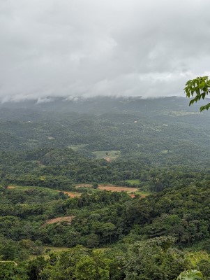
Before long we started the climb up into the Palm Hills in Manchester where the Jamaica Point of Inaccessibility is situated in Mile Gully.
This particular POI lies not far from the road, so I hadn’t brought the usual expedition gear. I did, at least, ditch the flip flops for trainers, but long-legged trousers would have been more useful than shorts. Whilst not particularly dense, the bush we climbed through contained a form of ivy that tore at our legs and caused a rash similar to nettle stings.
The offroad section was only about 60m but it was a steep hillside, which I’d estimate to be at around 45 degrees. Footing was a bit precarious and one slip resulted in a bloodied knee and cut leg.
Anyway, all said and done, the Jamaica POI was achieved.
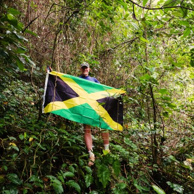
Jamaican Point of Inaccessibility
Weather: 21 Celsius, cloudy, some light rain.
Visited by: Chris Brown & Simika Harrison
Coordinates Achieved: 18° 10.4826’N, 77° 33.5493’W
Distance from Pole: 27 metres.
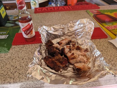
On the way back Trevor gave us a bit of a culinary tour. First up was traditional Jerk Chicken and Pork, washed down with flavoured Red Stripe and shot of Wray & Nephews over-proof rum. At 63% ABV, or 126° proof, it takes your breath away. I wouldn’t say it burned all the way down, but where the glass touched my lips went numb like being at the dentist!
Next stop was for a Beef Patty. and just to make sure we were well-fed, a stop at the border of Elizabeth and Westmorland for some prawns and clam soup.