Barbados
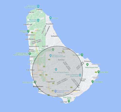
Barbados is divided into Parishes, and the Point of Inaccessibility for Barbados lies in St George Parish near Hilbury on Briggs Hill.
The exact location of the Barbados POI is:
- Latitude: 13° 8.5567’ N
- Longitude: 59° 33.1795’ W
- Distance from coast: 8.5km
These coordinates were calculated by Chris Brown in May 2024.
Mapped Location of Barbados Point of Inaccessibility
Getting to the Barbados Point of Inaccessibility
Barbados is the most easterly of the Caribbean Islands, although technically it is an Atlantic Island. It assumed independence from Britian in 1966 but English remains the main language which makes exploring the island very easy (for me, anyway). Barbados is approximately 34 km long by 23 km wide
You can get to within around 30m of the POI by cart thanks to a new building development where roads have already been installed. After that you need to ditch the flip flops and head into some light bush. We were under dressed for the occasion with just trainers and shorts, but they sufficed. A machete would have helped, but the bush wasn’t too dense.
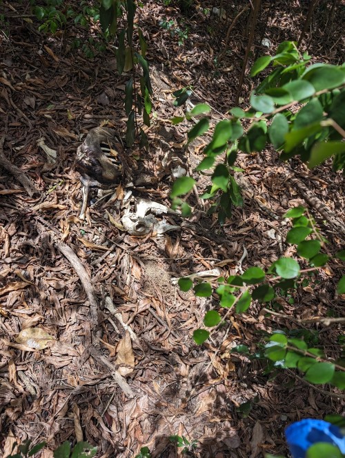
We did happen upon the carcass of a dead animal on the walk. Luckily for us it wasn’t an omen. The whole ‘expedition’ didn’t take more than two hours round trip from our hotel at St Lawrence Gap.
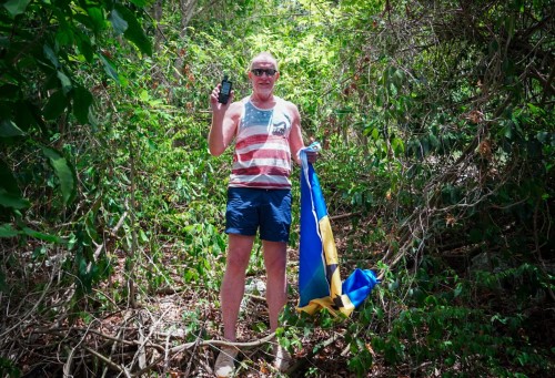
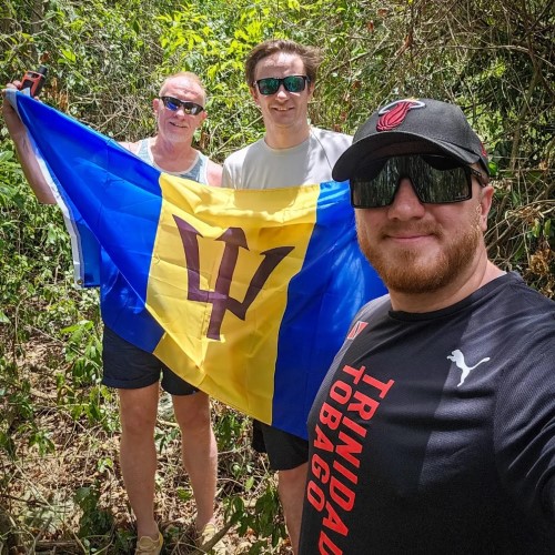
Barbados Point of Inaccessibility
Weather: 24 Celsius, sunny with some cloud.
Visited by: Chris Brown, Axel Brown and Mika Brown
Coordinates Achieved: 18° 10.4826’N, 77° 33.5493’W
Distance from Pole: Zero metres, exact POI acheived.