Iceland
The Icelandic Point of Inaccessibility lies on the Hofsjökull glacier in the Western highlands of Iceland just North of the Kerlingarfjöll mountain range. This glacier is the third largest ice cap in Iceland and lies between the Northwestern and Southern Regions, with the POI lying within the Southern region. The point is also on the Mid-Atlantic Ridge; that part of Iceland being pulled apart by movements of the Eurasian tectonic plate and the North American Plate.
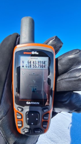
The exact location of the Icelandic POI is at:
- Latitude: 64° 43.955’ N
- Longitude: 18° 55.798’ W
- What3words: ///illustrated.purports.revolving
Location of the Point of Inaccessibility for Iceland
Getting to the Icelandic Pole
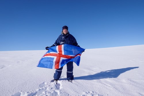
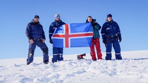
Date Visited: 29th March, 2022
Visited by: Chris Brown, Mika Brown, Axel Brown and Siggi Bjarni, with help from Addi Gauti
Weather: 2° Celsius, Clear Skies and Sun*.
Coordinates Achieved: 64° 43.955’ N, 18° 55.798’ W
Distance from Pole: Zero metres. Exact Pole Achieved
*Although the conditions at the Point were clear and sunny, the ascent had been in dense, freezing fog!
The team arrived in Iceland via Keflavik airport from the UK and met up with Siggi Bjarni, whom I first met in Antarctica on the 2021/22 failed mission to the Southern Pole of Inaccessibility, before progressing to the Midgard Adventure Basecamp in Hvolsvöllur via Reykjavik.
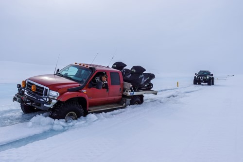
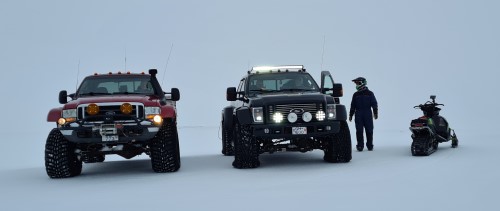
After a day’s warm-up Ice Climbing on the Sólheimajökull glacier, we made our way up into the highlands of Iceland in two enormous, winter-prepped super-jeeps, one of which was carrying two snowmobiles on the back.
The journey was hazardous because the two weeks preceding our journey had been unseasonably warm. This had caused a lot of the ice to melt, meaning there was a high chance that the truck would break through the top ice layer and fall down into the axle-deep slush underneath. Indeed, this is why we took two trucks instead of one, so that they could be used to pull one another out.
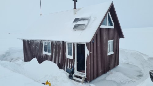
Despite the F26 road’s best endeavours to trap the team, we arrived at Siggi’s family hut slap bang in the middle of nowhere in the early evening. This mountain hut is amazing. It was built by Siggi’s grandfather in 1979 next to the Þúfuvötn lake using wood from the boxes used for parts used in the construction of hydro-electric plants in the highlands. Apparently the parts were so valuable only the best wood was used to crate them up. Sigurður Jónsson had also built the hut in such a way as to allow it to ‘breath’. So, whereas many other mountain huts in the region had decayed and fallen apart, this one is still in excellent condition.
Next day, we had a relatively early start in the trucks heading towards the Hofsjökull glacier. The main obstacle to this push was going to be crossing the Thjorsa river, Iceland’s widest and longest river. Given the melting of the ice, there was real concern that the thickness wouldn’t hold our trucks, so we took the snowmobiles off to decrease the weight. Luckily the temperatures had dropped the previous night and the ice held. So, we were able to make good progress with the snowmobiles riding ‘shotgun’ for the trucks.
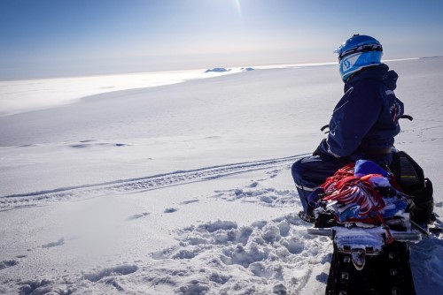
Near the base of the glacier, the team split. Addi stayed behind to look after the trucks and to provide an essential saftey relay-point in case of difficulty. The rest of the team proceeded up the glacier on Snowmobiles wearing harnesses as Siggi guided us between the crevices. As we climbed the fog/cloud seemed to thicken and then lighten. To our delight, just as we came within the last 500m of the Point of Inaccessibility for Iceland, we rose above the cloud to clear skies and sunshine. Visibility was at least 250 miles where we could see other mountain ranges.
About 150m short of the pole, we stopped the snow cats and proceeded on foot to the exact pole – the most inaccessible point in Iceland 🙂
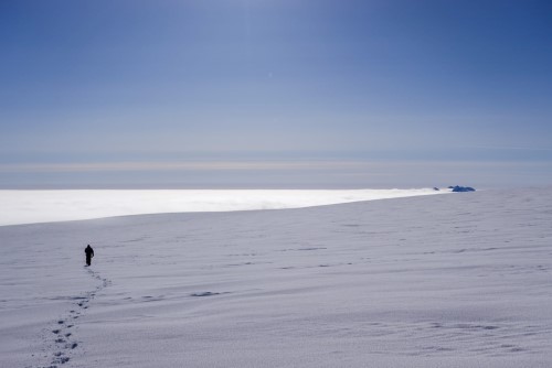
The white is not a lake, it is cloud in the valley below the glacier and the black rocks on the right are actually mountain peaks in the distance!
Video of the trek to the Icelandic Pole
Here’s a short video made by @TheAxelBrown covering the trip to the pole.