Point Nemo
Point Nemo, also known as the Oceanic Pole of Inaccessibility, holds the distinction of being the farthest point from any landmass on Earth. It is the opposite of all the other PIAs which are the furthest from the ocean in any direction.
This remote point lies in the South Pacific Ocean and is named after Captain Nemo, the sailor from Jules Verne’s famous novel Twenty Thousand Leagues Under the Sea.
Point Nemo can be found at:
- Latitude: 48°52.6’S
- Longitude: 123°23.6’W
- Distance from Land: 2,688km (approx 1,670 miles))
The coordinates were calculated by Hrvoje Lukatela, a Croatian survey engineer in 1992 using a geo-spatial computer program that incorporated the planet’s ellipsoid shape to calculate the point furthest from land.
Location of Point Nemo
The nearest land in each direction is:
– To the north lies Ducie Island, part of the Pitcairn Islands.
– To the northeast is Motu Nui, one of the Easter Islands.
– And to the south, you’d find Maher Island, part of Antarctica.
Hrvoje does actually highlight the [relatively] small uncertainties in his calculations. This is the same for all Poles and Points of inaccessibility: where, exactly do you take the edge of land to be? The islands we are dealing with for Point Nemo are rather small, so the Proximity Vertices don’t vary that much. The largest uncertainty is the coast of Antarctica, which is difficult to determine because of the ice shelf.
During discussions with Hrvoje he suggested visiting each island to locate the vertices, but that would simply be too impracticable. So instead, he suggested we visit not only the commonly accepted location of Point nemo, but also two other possibilities based on his latest calculations.
Since the three possibilities are only around 10 nautical miles apart, we thought we’d aim to do exactly that. The target coordinates are:
48°52.5291’ S 123°23.5511′ W
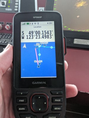
49°0.1548′ S 123°23.5116′ W
48°52.8721′ S 123°20.7696′ W
We would, of course, reserve our main celebration for the commonly accepted Point Nemo (the OG) which is based on The Digital Chart of the World (DCW – is a comprehensive 1:1,000,000 scale vector basemap of the world). In Hrvoje’s words, “DCW, while older and of lower density/resolution than the alternatives considered, is in my opinion a much more reliable source of geographical data than the other two.”
Point Nemo interesting facts
- The term “Nemo” itself is Latin for “no one,” which adds a mysterious allure to this already remote location.
- Due to its remoteness and relative lack of marine traffic, Point Nemo has become a popular location for space agencies to dispose of space junk. Dubbed the “Spacecraft Cemetery,” numerous satellites and space stations, including Russia’s Mir space station, have met their fiery demise in the waters near Point Nemo upon re-entry into Earth’s atmosphere.
- Point Nemo lies within the South Pacific Gyre, a huge system of rotating ocean currents that encompass much of the Southern Pacific Ocean influencing everything from water temperature to nutrient distribution.
- There are believed to be no fish or other marine life in the area with the lack of nutrients making it difficult for even the hardiest species to survive.
- The ocean floor is around 4,000 metres below the surface at Nemo
- The average water temperature is just 7.2°C.
Has anyone ever been to Point Nemo?
They have now 🙂
Maritime Professionals said, before our expedition, that “it is highly likely that nobody has ever been to Point Nemo“. And Hrvoje Lukatela himself said it was “possible that no human has ever passed through the specific coordinates at all“.
Equally we knew that expedition vessels had been in the area of Point Nemo, and we knew that The Ocean Race also passed by the coordinates – however, the organisers of the race have confirmed Point Nemo was not a “mark” so the race yachts didn’t have to go to the exact location.
Thus, at the beginning of the expedition, we couldn’t say if anyone had been to the exact coordinates or not. So what our expedition did, was to remove any doubt.
Getting to Point Nemo
I’d been looking for ways to get to Point Nemo for about five years before the ideal opportunity presented itself.
The most obvious way to get there would be to go in one of the aforementioned racing yachts. That would be the quickest, and possibly cheapest way to get there. However, I’m not a sailor and also getting on in years. So being thrown all over the place, wearing a survival suit 24/7 and having to contribute physically to the sailing made this my least preferred option.
My favoured method would be to go in something like a cargo vessel or tanker. My thinking here is that it would be the most stable option.
Sailors have a saying that “Below 40 degrees there is no law” and follow it up with “Below 50 degrees there is no God”. These sayings are, of course, referring to the rough seas and winds. Since Point Nemo is at nearly 49 degrees south, I think a sturdy option would be the best.
However, Point Nemo is so far from anywhere that there are no shipping lanes anywhere near it. To divert a tanker would entail a big change of route and huge expense.
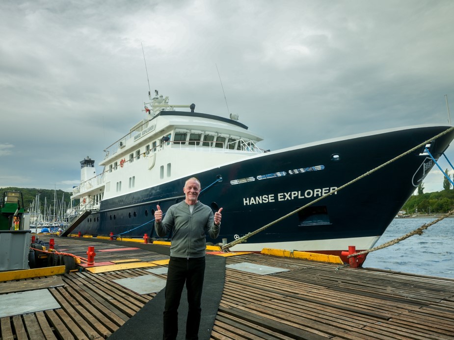
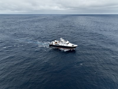
Then, out of the blue, I learned about an expedition yacht called the Hanse Explorer that would be repositioning from its summer expeditions (in the southern hemisphere), taking customers down to Antarctica, over to French Polynesia. It is a solid vessel with an impressive ice rating and experienced expedition crew. So, after a bit of negotiation, they agreed to reposition via our goal of Point Nemo.
So, it came to pass that on 12th March 2024, we left Puerto Montt in Chile with the destination of getting to the commonly accepted coordinates of Point Nemo, plus the two secondary coordinates presented by Hrvoje Lukatela.
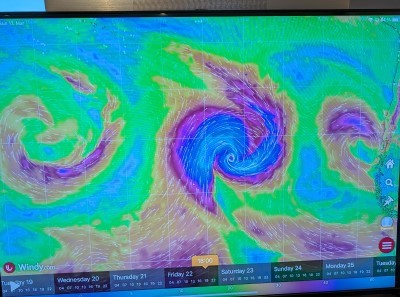
The weather was always going to be a big consideration on such an expedition, and so it proved. The first two days out of port featured waves of 6-7 metres, leading to quite a few queasy stomachs!
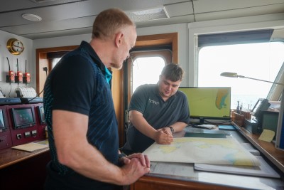
I’ve mentioned many a time on my expeditions that you need to surround yourself with experts in the field in order to bring about a successful expedition.
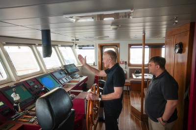
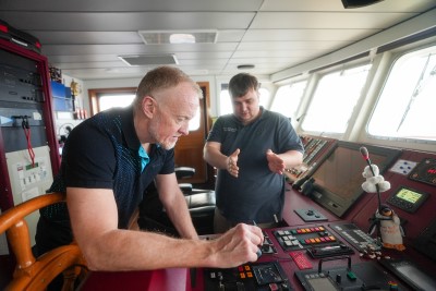
I’ve mentioned many a time on my expeditions that you need to surround yourself with experts in the field in order to bring about a successful expedition. On this occasion, Captain Andriy Bratash was that man. He plotted us a course between high winds that took us initially a bit North West to avoid the impending 11m waves, before turning back West South West.
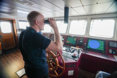
After another two days, the seas were down to 2m, meaning the Hanse could speed up. Apart from our desire to reach Point Nemo as soon as possible, we were also in a race against time with a depression forming East of New Zealand that was predicted to reach Hurricane force. We certainly didn’t want to be in the region when that came through!
We arrived in the vicinity of Nemo on 20th March having made good time. First stop was “Alternative 2” from Hrvoje’s calculations at 48°52.8721′ S 123°20.7696′ W
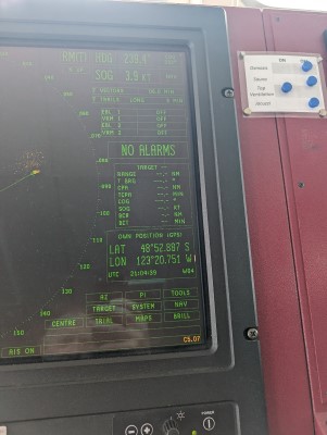
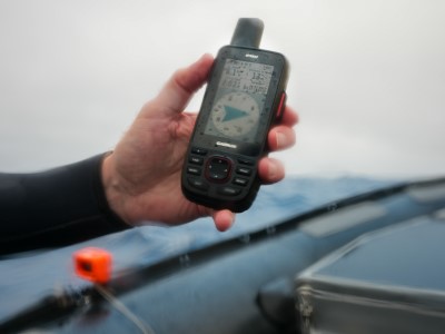
Captain Andrij managed to manipulate the wind and currents to get the Hanse Explorer to pretty much the exact point. Indeed, the ship’s GPS put us within 3 metres, but given the size of the boat, at least one part would be exactly on target.
One hour later we arrived at the commonly accepted coordinates for Point Nemo.
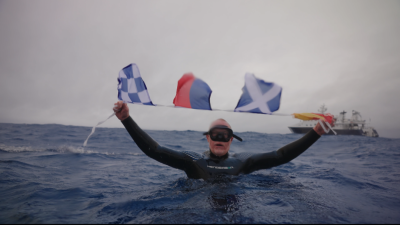
At all of the other Poles of inaccessibility, I’ve stood on the exact spot and taken photos holding the flag of the country in which the Pole lies and my GPS “proof”. Obviously, this wouldn’t be possible at Nemo.
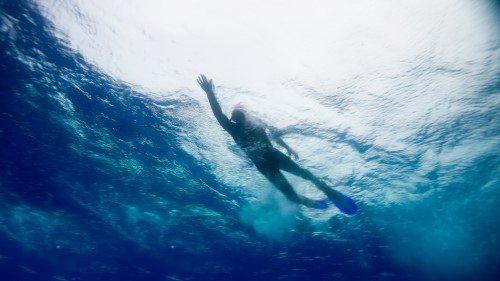
So, I came up with the idea of getting in the water at the exact coordinates. And, in the absence of a Southern Pacific flag, I made up a short piece of bunting with four maritime signalling flags to spell out N.E.M.O.
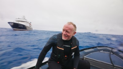
With the Hanse holding position about 50m from the Pole we got into wetsuits and set off to the exact coordinates in two Zodiac RIBs .
Three minutes later we’d positioned exactly at Point Nemo, and with a quick backward flip, I became the first person to enter the water and go for a swim at the remotest place on the planet.
Adam Watson soon joined me to take some photos and videos, followed by my son, Mika.
The water wasn’t too cold at around 10 degrees Celsius, but what struck me when I put my face in the water was how blue it looked. I’d expected a dark blue, verging on black, given the water depth is around 4km at this spot. But it was a vivid, almost radiant, azure blue.
Waves were already up to around 2.5 to 3 metres – which made swimming a bit of a challenge – due to an impending hurricane force storm. Thus, our time in the water was cut short so we could stow the Zodiacs and prepare to high tail it out of the region.
Before doing that, though, we popped down further south by around 10nm to ‘bag’ the Point nemo “Alternative 1” at 49°0.1548′ S 123°23.5116′ W.
All versions of the Oceanic Pole of Inaccessibility achieved, we set sail for Papeete where the expedition would end.
Point Nemo Achievement
Date Visited: 20th March, 2024
Visited by: Chris Brown, Mika Brown, Adam Watson and Doug Sheilds
Weather: 12 Celsius. Cloudy skies with impending storm.
Sea: 9 Celsius and 2.5m waves.
Coordinates Achieved: 48°52.6 S 123°23.6′ W
Distance from Pole: Zero metres. Exact Pole achieved.