Great Britain
As with all PIAs, it is easy to get pulled into a debate about how to calculate the location, rather than over the location itself. Remember the British Pole of Inaccessibility marks the geographical point which is furthest from the coastline. It is not, necessarily, the centre of the country.
The British PIA has been calculated by The Ordnance Survey, Britain’s National Mapping Agency, and reported by the BBC, to be at:
- Latitude: 52° 43.6’ N
- Longitude: 1° 37.2’ W
- Distance from sea: 113km
It is a point near Church Flatts Farm about 1km south east of Cotton-in-the-Elms, Derbyshire. This British Pole of Inaccessibility is 113km from the nearest point on the coast at the mean low-water line (that being Fosdyke Wash, Lincolnshire). The Ordnance Survey grid reference is SK 257144
The original Garcia-Castellanos and Lombardo algorithm put the British PIA at Latitude: 52° 39.0’N and Longitude: 1° 33.4’W approximately 11km from the Ordnance Survey result.
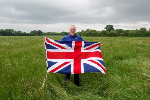
Getting to the British Pole
Getting to the Great British Pole is pretty simple and you can drive to within about 20m.
What a surprise – the pole is in an unremarkable, flat, grass field!
Date Visited: 20th June 2021
Visited by: Chris, Axel and Mika
Weather: Overcast
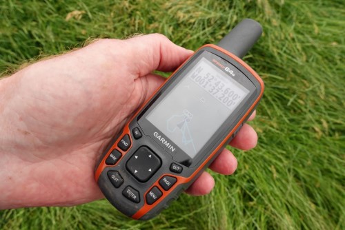
Coordinates Achieved: 52° 43.6’ N 1° 37.2’ W
Distance from Pole: Zero metres. Exact Pole Achieved
Centre of Great Britain
The Centre of Gravity of Great Britain has, again, been calculated by the Ordnance Survey and they prefer to factor in the 400+ Islands associated with Great Britain and they calculate (using the Centre of Gravity method) the centre of Great Britain to be at grid reference SD 64188.3 56541.43 or 54°0’13.176 N 2°32’52.278 W. This location is on Brennand Farm, 7km north west of Dunsop Bridge in the Forest of Bowland, Lancashire.
When the OS only looked at mainland Great Britain, and using the same method, they calculated the centre to be at 4km North West of Calderstones Hospital, near Clitheroe, Lancashire at grid reference SD7232136671.
Apparently, the same calculation was first made by Brigadier Winterbottom in the Geographical Journal of 1941
Using the Longitude Method, you would favour a point near Haltwhistle in Northumberland near Hadrian’s Wall
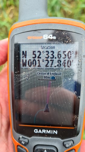
Centre of England
In keeping with their calculation for the centre of Great Britain, the OS used England’s Islands to calculate the centre to be at SP 36373.66, 96143.05 (52°33’42.942″N 1°27’53.474″W) on Lindley Farm between Atherstone and Hinckley in Leicestershire
Getting to the Centre of England
We visited the Centre of England followed by the British Pole of Inaccessibility on Father’s Day 2021 after having completed a Swim-Run event in Nene Park, Peterborough.
Firstly, the Centre of England is, perhaps, best approached by a minor road off the A5 between the Royal Redgate junction and the MIRA Technology Park. This rough track takes you to within several hundred metres of The Centre.
The Centre of England itself lies in a field (no surprises there) which contained crops when we visited. We used tramlines to get as close as possible but didn’t access the exact Centre because we didn’t want to damage any crops. There had been quite the downpour the previous few days, so even this little trek resulted in some of the muddiest boots you’ll ever see and soaked trouser legs – yes, we were underprepared!
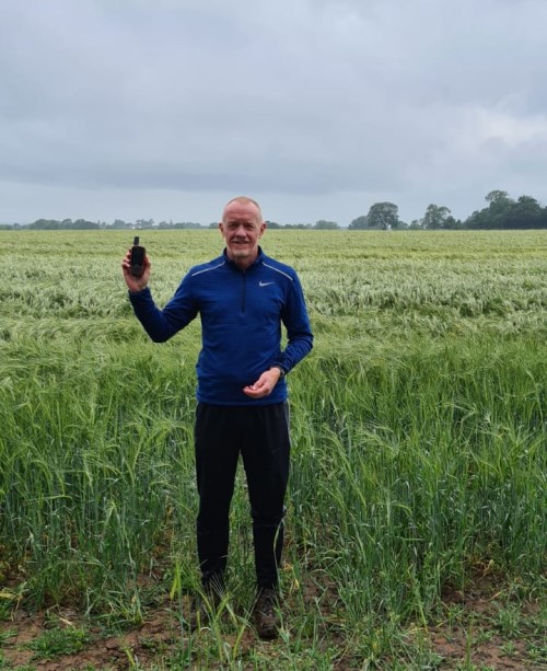
where I’m standing
the Centre of England
Centre of Scotland
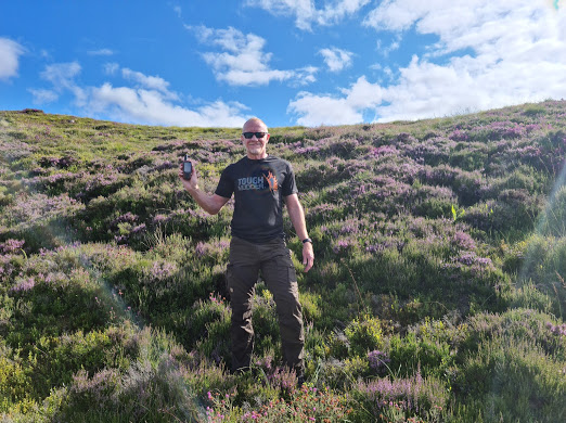
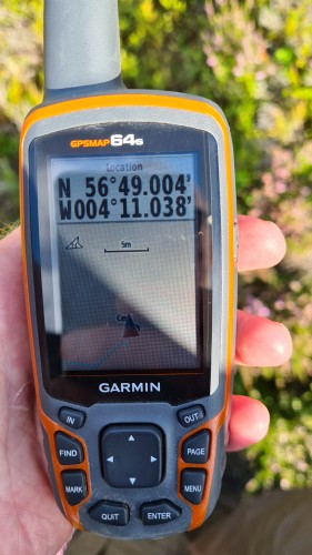
Lies between Blair Atholl and Dalwhinnie at grid reference NN 66784.93, 71599.4 (56°49’0.257″N 4°11’2.267″W).
Getting to the Centre of Scotland
I took the opportunity to visit the Centre of Scotland when in the country for a friend’s wedding in Dumfries and Galloway. I’d expected a drive North but didn’t realise it was going to take something over 3hrs more!
Just like the Centre of England, the Centre of Scotland can nearly be accessed by car on the north-bound carriageway of the A9 road. There’s a very convenient small track at the side of the main road which takes you down to a siding next to the railway and a place to park.
From there you can walk down and cross the River Garry (there’s an old bridge) then up the Dun Coillich hill on the other side to access the Centre which is located in ankle-high heather.
Centre of Wales
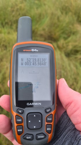
This lies about 2.5km from Cwmystwyth at grid reference SN 79728.22, 71704.43 (52°19’48.791″N 3°45’59.072″W).
Getting to the Centre of Wales
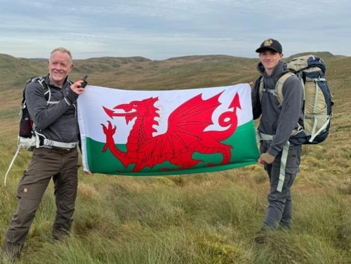
I undertook the geographic Centre of Wales as part of a collaboration adventure, more detail here, in October 2023.
After a lengthy drive from Home, we stayed in Devil’s Bridge, Hafod, about 5 miles as the crow flies from the centre of Wales (CoW).
The plan had been to walk to the CoW from the hotel which looked like a 3 hour walk on maps. However, after media photography and TV interviews, time had marched on, so we drove to a car park about halfway to the point.
Good job that we did, because the walk from the car park took nearly three hours as it was, over numerous bogs and steep moorland.
The exact Geographic Centre of Wales was achieved by the entire party of Chris Brown, Max and Mark Woosey, Simika Best and Emma Cantrill.