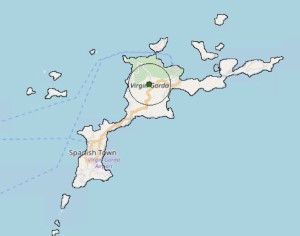
Virgin Gorda
The Virgin Gorda Point of Inaccessibility is in some dense bush on the side of the side of Gorda Peak, fairly close to the highest point on the island.
The exact location of the Virgin Gorda PIA is determined to be at:
- Latitude: 18°29’14.7″N
- Longitude: 64°24’01.8″W
- Distance from sea: 1,374 metres
These coordinates were calculated by Miso for Chris Brown in July 2019.
Map of Virgin Gorda Point of Inaccessibility
Virgin Gorda is an island in the British Virgin Islands due East of Puerto Rico. Its gets its name from Christopher Columbus who thought the outline reminded him of a reclining woman, or ‘fat virgin’.
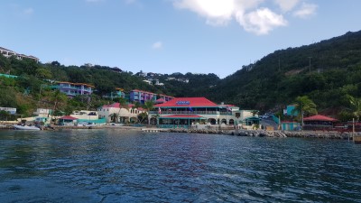
The PIA lies on the northern section of the island and is best accessed from Leverick Bay or Baker’s Bay.
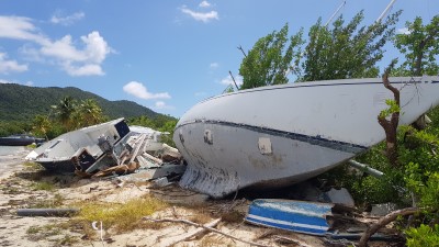
In common with the rest of the BVI, Virgin Gorda was, in 2019, still recovering from Hurricane Irma which devastated much of the region in September 2017. Around 80% of buildings had been rebuilt and the community seemed to be back on its feet.
Getting to the Virgin Gorda Pole
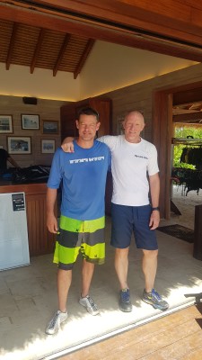
Date Visited: 16th October, 2019
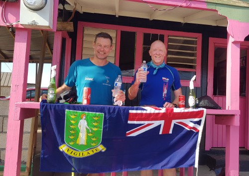
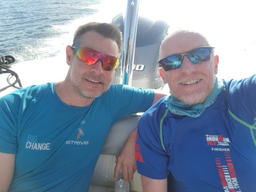
Visited by: Chris Brown & Luke Hepworth
Weather: 31 Celsius/88 Fahrenheit. Clear skies and Sunny.
Coordinates Achieved: N 18 29.245, W 64 24.030
Distance from Pole: Zero metres. Exact Pole achieved
Having looked at the Virgin Gorda Point of Inaccessibility on Google maps, using the satellite view, it looked like the trip was going to be pretty easy. The terrain was obviously overgrown, but comparing it to vegetation on Necker Island, where we were staying, it looked like we’d only have to dodge a few cacti and wade through some grass.
How wrong could we have been. The journey turned out to be much, much harder than expected.
Our original plan had us swimming the approximate 5.5km from Necker to Gorda to make it a ‘bit more of a challenge’. But having swum round Necker a couple of days earlier, and experienced the high swell, we decided to kayak and land at Leverick Bay.
The climb out of Leverick up towards the pole is steep, with an average gradient of about 10 % containing some kickers closer to 30%. We’d done a cycle race on the island in 2016 so at least this was no surprise. Roads take you to within around 120m of the PIA.
Turning off the road it rapidly became apparent we were heading into denser bush than we’d anticipated. The first 40m was about what we’d anticipated, but soon the density increased and slowed our progress. The next 80m took us close to 25 minutes to cross, breaking down undergrowth with our feet and clambering over hidden rocks.
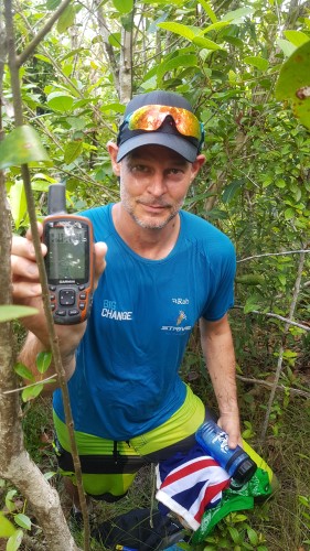
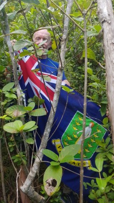
We were grossly under prepared, wearing just trainers and shorts. If you wish to replicate this journey, wear boots, trekking trousers and bring a machete! The image below, which shows there’s barely enough room to unfurl the BVI flag might give you some indication of the task.
Chris at Virgin Gorda Point of Inaccessibilty 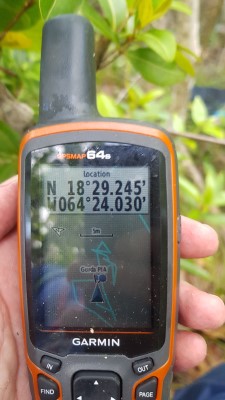
PIA Coordinates acheived
Mission accomplished!