New York
The New York State Point of Inaccessibility lies upstate in the Ferris Lake Wild Forest, North of Dolgeville and West South West of Higgins Bay, and fairly close to Jerseyfield Lake
The exact location of the New York POI is determined to be at:
- Latitude: 43° 18.180’ N
- Longitude: 74° 48.422’ W
- Distance from sea: 116.6km or 72.5 miles
These coordinates were calculated by Miso for Chris Brown in July 2019.
This point is in dense forestry, but it appears, from the satellite photo, that you could get within around 300m by travelling down the Billy Hamlin Road.
Location of the New York Point of Inaccessibility
Getting to the New York Pole
As far as I’m aware, nobody has purposefully travelled to the New York State Point of Inaccessibility.
Manhattan Point of Inaccessibility
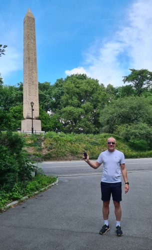
The Centre of Manhattan, or Point of Inaccessibility for Manhattan lies, not surprisingly, in Central Park. It lies just off East Drive between The Obelisk (an historic obelisk with Egyptian writing down the column) and the Metropolitan Museum of Art.
Location of the Manhattan Point of Inaccessibility
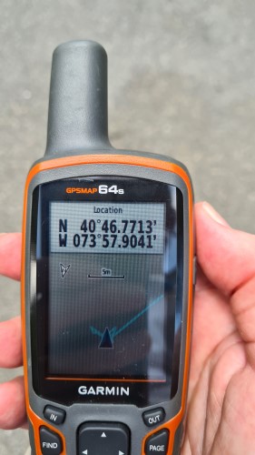
The exact location of the Manhattan Point of Inaccessibility is:
- Latitude: 40° 46.771’ N
- Longitude: 73° 57.904’ W
- See also: North American Pole of Inaccessibility