Luxembourg
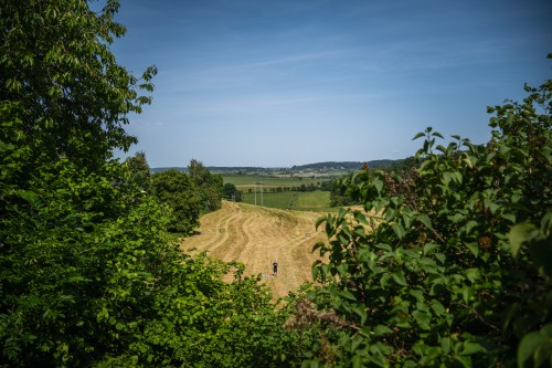
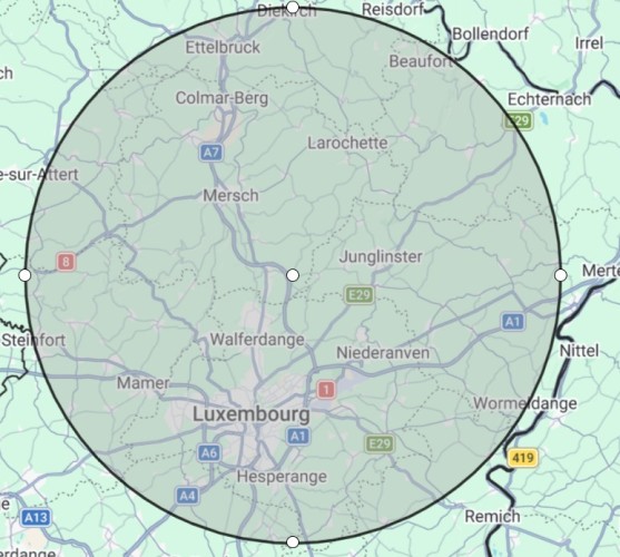
The Luxembourg Point of Inaccessibility lies at Blaschette (Blaaschent), a small village in the commune of Lorentzweiler, in the canton of Mersch in central Luxembourg. The point is on the western/south-western side of the village, roughly 10 km north of Luxembourg City and just east of the Alzette valley. Blaschette sits on higher ground between Lorentzweiler and the extensive Grünewald woodland; administratively it is one of several small settlements belonging to Lorentzweiler.
- Latitude: 49° 41.9787‘N
- Longitude: 006° 10.0303‘E
- Distance from Border: 18.8km
These coordinates were calculated by Chris Brown in February 2026.
Mapped Location of the Luxembourg Point of Inaccessibility
Getting to the Luxembourg Pole
We visited the Luxembourgish Point of Inaccessibility on my 2,700km drive from Yorkshire down to the Dalmatian Coast in Croatia on the same day that we visited the Belgian POI.
As you might imagine, in this small and densley populated country, getting there was really easy. Indeed, the major A7 road takes you to within a few kilometres, then a minor road, the 122, will get you to within 100 metres of the actual POI coordinates.
Of course, driving there in an all-electric hypercar, the Rimac Nevera Time Attack, made the journey even more comfortable and enjoyable.
Parking on the road, we first tried to access the Point of Inaccessibility – which is in a gently sloping farmer’s field with fantastic views – via some nearby houses. Simika spotted a man walking a dog, so we went to ask him if there was a footpath between the houses.
That didn’t work out too well. First of all, the dog was a Malinois. Secondly the gentleman didn’t speak French or English, so we struggled to converse in my very-limited German. He was deeply suspicious of why we’d want to find a path. I could see it was going nowhere, so just thanked him and went for a different approach (which actually turned out to be much easier anyway).
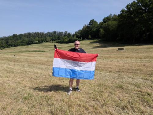
Back at the cars we found a fairly steep access road down towards the field that had been partially hidden by hedges. Lo and behold, it went straight into the field.
Unlike in Belgium, this field was freshly cut grass, so we didn’t risk any damage by entering the field and simply walking directly to the exact Point of Inaccessibility.
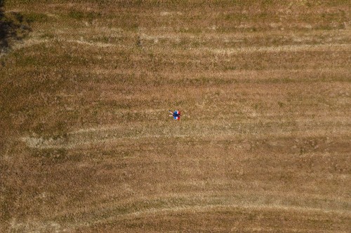
The weather was nice, very warm and the views were fantastic, so we lingered a while to take in the views, take a few photos and drone shots, before moving on with the long drive to Croatia.
Date: 29th May, 2026
Weather: 32° Celsius. Sunny with clear skies.
Visited by: Chris Brown & Simika Best
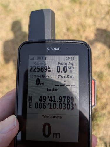
Coordinates Achieved: 49° 41.9789’N, 006° 10.0303’E
Distance from Pole: 0 metres.